Five days, one crossing of the Thames, and a coastline that changes completely every morning.
This route takes you from Abberton down through Kent to Canterbury and the Channel coast, then west through Rye and Romney Marsh to finish on the chalk cliffs of the South Downs.
It covers a lot of ground for five days, so the drives are a little longer than on our Suffolk and Norfolk routes. Nothing here is rushed, but you will be moving each day.
Why choose Kent and the South Downs?
This is the oldest inhabited corner of England and it shows. Within a few miles you can stand in a cathedral that has been a place of pilgrimage for eight hundred years, walk through a Roman fort, and look across the water at France from a cliff top.
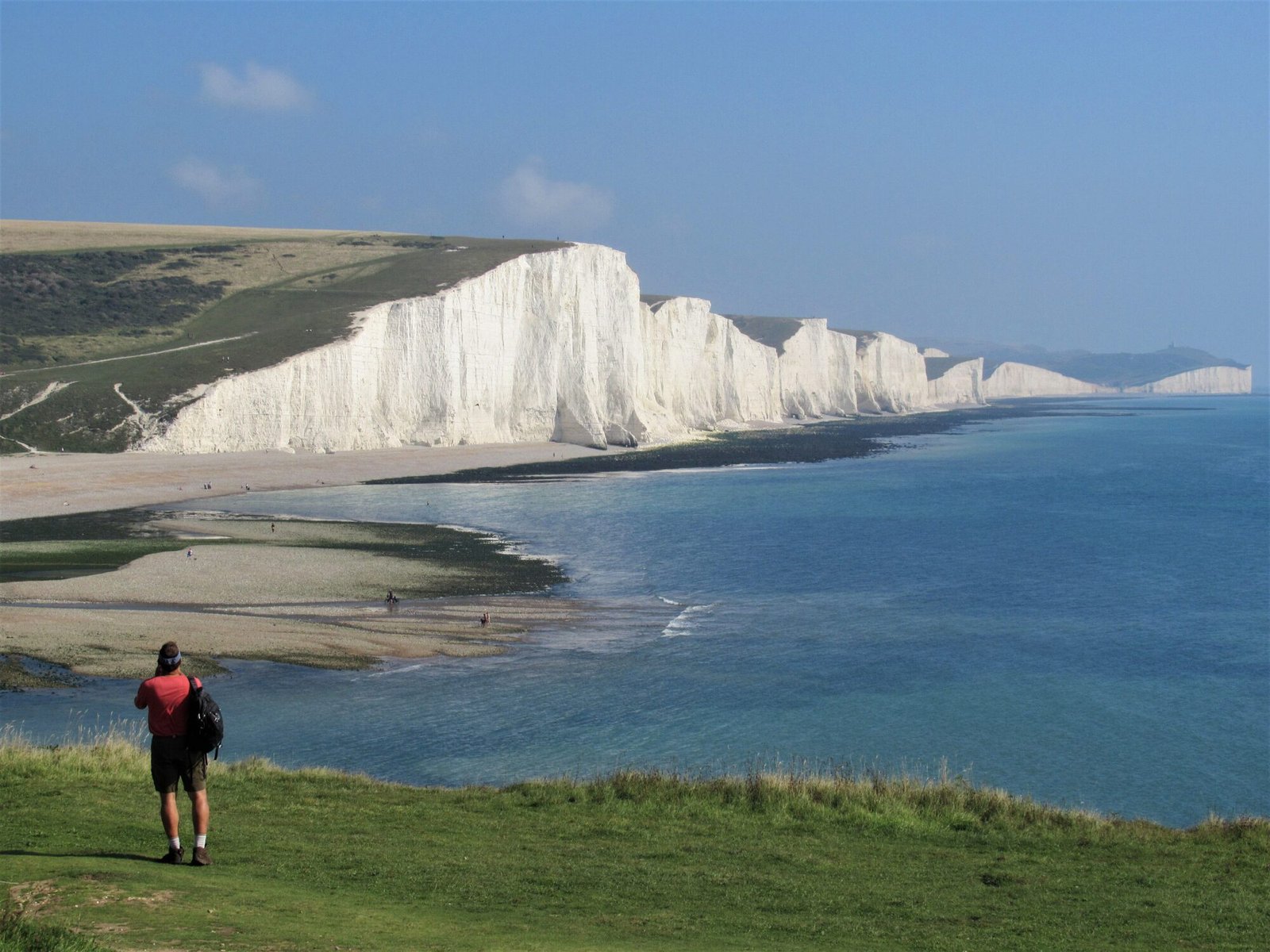
The coast is unusually varied. Oyster beaches and beach huts in the north, white chalk and wartime tunnels in the east, shingle and open sky across Romney Marsh, then the sudden green and white of the Seven Sisters.
It also works well out of season. Much of what is worth seeing here is outdoors and free, and the towns are pleasanter in October than in August.
Day 1: Abberton to Canterbury
Across the river and into Kent
The first drive is the longest planning decision of the trip, because it crosses the Thames. The Dartford Crossing is not a toll booth: the charge is paid online or by phone, and it must be paid by the deadline published by the operator or a penalty follows.
Check which vehicle class your motorhome falls into before you travel, and pay the crossing the same day rather than trusting yourself to remember it on day four.
Once across, Canterbury is about an hour. Use one of the park and ride sites rather than driving into the centre. The cathedral, the ruins of St Augustine’s Abbey and the Westgate towers are all within a short walk of each other, and the river runs through the middle of the city with punts on it in season.
There are sites to the east of Canterbury and towards the coast at Whitstable and Herne Bay. Check the approach lanes, which can be narrow, and confirm vehicle length limits.
Pay the Dartford Crossing charge the day you cross. It is the single most common thing people forget on this route.
Day 2: Whitstable and the north Kent coast
Oysters, shingle and beach huts
Whitstable is a working harbour town that has become fashionable without quite losing the working part. The oyster trade here goes back to Roman times and the harbour market is still the best place to eat them, standing up, from a stall.
Walk east along the shingle to Tankerton, where the beach huts line the slopes above the sea. At low tide a shingle spit called The Street runs out from the shore for the best part of a mile, which is an odd and very good walk if you time it right and turn back in good time.
Herne Bay, further round, is quieter and has a handsome clock tower and the stump of its old pier standing offshore.
In the afternoon, head south and east towards Sandwich, a medieval town that was once a major port and is now two miles inland because the sea left. The street plan has barely changed in five hundred years.
Consider sites around Sandwich and Deal for tonight, which puts you next to tomorrow’s coast. Book ahead in summer and during golf events, when this area fills up.
Check the tide before walking out on The Street at Tankerton. It covers from both sides.
Day 3: Deal, Dover and the white cliffs
The edge of England
Deal has a long shingle beach, a pier you can walk to the end of, and a squat Tudor artillery castle built by Henry VIII in the shape of a rose. The seafront here is one of the most pleasant in Kent and almost nobody outside the county talks about it.
From Deal, follow the coast south to St Margaret’s Bay and the cliff top. The National Trust visitor centre above Dover is the usual starting point for the white cliffs walk, and the path runs east along the top towards the South Foreland Lighthouse. On a clear day France is plainly visible.
Dover Castle sits above the town and is far more than a castle. The wartime tunnels cut into the chalk beneath it were the command centre for the Dunkirk evacuation, and the guided route through them is the best hour you will spend on this trip. Allow most of a day if you intend to see the castle properly.
There are sites above Dover and inland towards Folkestone. Cliff top pitches are exposed, so think about the forecast before choosing one.
The cliff path is unfenced in places and the edge is undercut. Keep well back from it, especially with children or a dog.
Day 4: Romney Marsh, Dungeness and Rye
Flat land, big sky
Today is completely different again. Romney Marsh is reclaimed land, flat and open, crossed by drainage channels and dotted with isolated churches that stand in fields with no village left around them.
Dungeness, at the southern tip, is one of the strangest places in England. A great shingle headland with two lighthouses, a power station, a scatter of black timber houses and fishing boats pulled up on the stones. Derek Jarman’s garden at Prospect Cottage is here, laid out in shingle and driftwood. It is a private house, so look from the road.
The Romney, Hythe and Dymchurch Railway, a main line in miniature, runs along the coast to Dungeness and is a genuinely good way to arrive.
Finish at Rye, just over the Sussex border. Mermaid Street is the cobbled one everybody photographs, and the Ypres Tower above the town has a view over the marsh to the sea.
Look at sites around Camber, Winchelsea and inland of Rye. Camber Sands has large dunes and a long beach, and the car parks there have clear height restrictions worth checking in advance.
Rye’s old town is steep and cobbled with very tight corners. Park below it and walk up.
Day 5: The Seven Sisters and the journey home
Chalk, then east
Head west into the South Downs National Park for the last morning. Cuckmere Haven, where the river meanders to the sea through open downland, gives the classic view of the Seven Sisters cliffs. The walk from the car park at Exceat down to the beach is level and about a mile each way.
Birling Gap, a little further on, has steps down to the shore and a National Trust visitor centre. Beachy Head is above it, the highest chalk sea cliff in Britain.
Then turn for home. The run back to Abberton is around three hours, and it crosses the Thames again, so allow for the crossing charge a second time and for the traffic around the M25.
Your return time is agreed when you hire your vehicle. On this route in particular, build in extra time for the M25 and the crossing.
Make the most of the five days
A few simple things will make this route easier:
- Book your overnight stops in advance. Popular sites fill quickly during school holidays and summer weekends.
- Check access before you travel. Some car parks have height barriers, narrow approaches or vehicle length limits. Never assume a space is suitable for your motorhome.
- Keep your days flexible. The suggested stops are options, not a checklist. There is no need to see everything.
- Travel light and plan your supplies. Stock up on essentials before leaving, then enjoy discovering local shops and food along the way.
- Respect the countryside. Follow local parking rules, take your rubbish with you and leave overnight stops as you found them.
- Check opening times and seasonal services. Ferries, boat hire, attractions and campsite facilities may not operate all year.
Ready for Kent?
Few routes of this length change character so completely from one morning to the next. Oyster stalls, wartime tunnels, a shingle desert and a chalk cliff, inside five days and without a single very long drive.
If you have a sixth day, spend it in the South Downs rather than adding another town.
PWS Go, your adventure starts here.
Suggested itinerary only. Driving times, routes, campsite availability and attraction opening arrangements vary. Please confirm suitability for your hired vehicle and make bookings directly with the relevant providers before departure.